Supporting the Next Generation of Marine Geospatial Professionals
While hydrographic and cartographic professionals have traditionally focused on data collection and product creation, today’s marine information environment requires a much broader perspective. Marine geospatial data is increasingly expected to support a diverse range of activities, including marine spatial planning, environmental management, offshore renewable energy development, port operations, emergency response and wider blue economy initiatives.
As the demands placed on marine data continue to expand, developing the skills required to effectively manage, govern and share this information has become increasingly important.
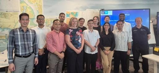
To help address this challenge, OceanWise continues its commitment to capacity building within the hydrographic and marine geospatial community through its involvement in the IHO-Nippon Foundation Geospatial Marine Analysis and Cartography (GEOMAC) project, delivered at the UK Hydrographic Office. In addition to the internationally recognised Cat B GEOMAC course, OceanWise delivers a supporting Data Management module and practical skills needed to manage marine geospatial information throughout its lifecycle.
The GEOMAC project brings together professionals from national hydrographic offices and maritime authorities around the world, helping to develop the next generation of marine geospatial specialists and strengthen international collaboration across the sector.
The OceanWise Data Management module introduces participants to the principles of data governance, metadata, data quality, interoperability, standards, Marine Spatial Data Infrastructures (MSDIs) and organisational change. Through practical examples and international best practice, attendees learn how data can be transformed from isolated datasets into strategic organisational assets that support multiple users, disciplines and applications.
Commenting on the programme, Caroline Levey, Managing Director at OceanWise, said:
“Marine geospatial data is one of the most valuable assets organisations hold, yet its full potential is often not realised. Through the GEOMAC programme, we aim to equip participants with the knowledge and practical skills needed to manage and govern data more effectively, ensuring it can be shared, reused and applied across a wider range of marine and coastal challenges. By developing these skills, we are helping to support the next generation of professionals who will shape the future of marine geospatial information management.”
The GEOMAC programme brings together professionals from national hydrographic offices and maritime authorities around the world, creating opportunities to share knowledge, develop expertise and strengthen global collaboration within the hydrographic and marine geospatial community.
For more information on the project or how the UKHO’s experts are delivering the course, please visit the IHO website: https://iho.int/iho-nf-geomac-project
For more information on OceanWise’s marine data management and MSDI training services, visit: https://www.oceanwise-global.com